You are looking at posts tagged with School Routes.

Tuesday, September 11, 2007

Process: Mapping The Morris Isaacson High School Route

Date: 24 July 2006
Route guides: Mpafi Mpafi and Oupa Moloto
Facilitator: Ali Hlongwane
Documenter: Ismail Farouk

Early on the 24th of July 2006, a bitterly cold morning, our research group set off from the Hector Pieterson Museum and Memorial (HPMM) to retrace the main route from Morris Isaacson High School in Central Western Jabavu to Phefeni Senior Secondary School in Orlando West. Our objectives were to map the route and identify important landmarks and places of interest along the way.

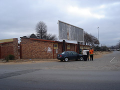
Our beginning point was Jabulani Hostels in Moahloli Street at the point before the street becomes Mputhi Street. “Jabulani” means happiness. However, Mpafi Mpafi reminded us that the history of Jabulani Hostel dwellers and their relationship with township residents was not always happy. Running battles between hostel inmates and township residents occurred here during 1976.

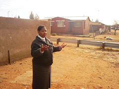
outside jabulani hostels
Figure: The Research Group Standing Outside Jabulani Hostels

Factors contributing to the hostility between hostel dwellers and township residents include the use of hostel inmates as strike breakers during the stay-away of 23 -25 August 19761. The Soweto Students Representative Council (SSRC) called for mass stay-away protests between August and November 1976. Hostel dwellers ignored this stay-away call because of the intervention of the police, Inkatha and the Soweto Urban Bantu Council. This led to the harassment of hostel dwellers by township youth. Other factors included the nature of the hostel institution which created class separation from the rest of the township community1. Living conditions in hostels were squalid and inmates had no rights whatsoever. Hostels were made up of large halls with communal facilities. Common water taps, showers and toilets were provided outside hostels. The poor conditions within hostels encouraged anti-social behaviour.

From Jabulani Hostels it is possible to see the Oppenheimer Tower in the distance. We headed off towards the tower by first travelling north on Mputhi Street and then west, by turning left into Taelo Street. At the intersection of Mputhi and Taelo streets there was much paving activity, part of the JRA sidewalk paving project.

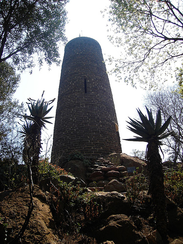
We reached Oppenheimer Tower complex which is set within parklike surroundings. The tower was built in 1955 from ash bricks which were the remains of shantytowns.

Oppenheimer tower
Figure: Oppenheimer Tower

The view from the tower provides a sense of the vastness of Soweto. From here looking south, there is a great view of the train-like housing architecture of Jabulani Hostels. Further in the south-west, the West Rand Administration Board (WRAB) Fresh Fruit Market is visible. The WRAB Fresh Fruit Market was set alight and destroyed on June 16 1976. We were reminded of the violence of that day’s events by Oupa Moloto recalling the gruesome sight of a headless boy lying on the ground with a cabbage under each arm.

View of Soweto
Figure: The vastness of Soweto from Oppenheimer Tower

Other landmarks visible from the tower include the 1976 memorial acre and the former home of Tsietsie Mashinini (see below), both of which are located close by in the suburb of Central Western Jabavu which surrounds the tower complex to the north and east. Still within the Oppenheimer gardens, we took a moment under the shadow cast by the Oppenheimer Tower where Mpafi Mpafi reminded us of the running battles between township residents and hostel dwellers which occurred in the park. He also pointed out that the gardens were a place of refuge for students who hid amongst the trees.

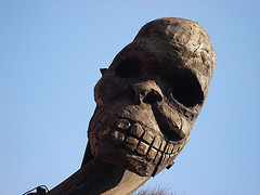
The Oppenheimer Tower is located adjacent to The Credo Mutwa Cultural Village. The village, also known as Khayalendaba, or "Place of Stories", has always been associated with story-telling, rituals and ceremonies, plays and other cultural activities. Its founder, Credo Mutwa is a Zulu Sangoma or traditional healer, a cultural historian and an award-winning nature conservationist in South Africa. Credo who is over 80 years old, is known worldwide as the Zulu Shaman. In 1976 students thought he was a collaborator and his house in Diepkloof was burnt down in the aftermath of June 16. Later most of the cultural village was destroyed too because of Credo Mutwa’s testimony in the state’s official enquiry into the student uprisings.

Credo Mutwa
Figure: Mythological Sculpture at Credo Mutwa

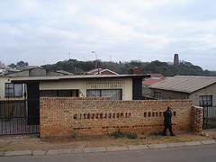
From the Credo Mutwa Village and Oppenheimer Tower complex we headed back to Mputhi Street and parked across from Morris Isaacson High School at the 1976 Memorial Acre, which is in the process of development. Mpafi remarked that it was students from Morris Isaacson High School who were central to the planning of the student march on June 16. One such student, Tsietsie Mashinini, lived across the road from Morris Isaacson High School.

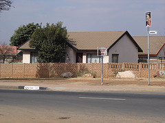
House Tsietsie Mashinini
Figure: The Home Of Tsietsie Mashinini

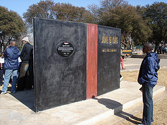
Today, the family of Tsietsie Mashinini is trying to purchase the former family home with a view to converting it into a family museum in honour of the fallen hero. The 1976 Memorial Acre contains a newly erected monument in Tsietsie’s honour. The monument was created as part of the Sunday Times Heritage Public Art programme. Its physical form resembles a giant book which symbolizes the crisis in education experienced in 1976. On the face of the book is the map of the route taken by the students from Morris Isaacson High School to Phefeni Junior Secondary in Orlando West, whilst the back cover of the ‘book’ is inscribed with a tribute to Tsietsie Mashinini.

Tsietsie Mashinini Monument (Sunday Times)
Figure: Monument to Tsietsie Mashinini

We continued up Mputhi Street past the killing site of Dr Melville Edelstein. Dr. Edelstein was one of two white officials beaten to death that day. A sociologist, Dr. Edelstein worked closely with many youth from Soweto. Earlier on the fateful morning, he greeted students as they past his house on Mputhi Street. However, once news of Hector Pieterson's death filtered through the ranks, happiness turned to anger and Dr. Edelstein was murdered for being a white man in the wrong place at the wrong time. Ironically, Dr Edelstein had warned that the hostility of township youth should be taken as a serious threat to peace in Soweto. In his thesis, written five years prior to the events of June 16, "What Young Africans Think” (1971), 73 percent of the youth interviewed listed inadequate political rights among major grievances.

Dr. M. Edelstein
Figure: Dr. Melvillle Edelstein's body was found here on Mputhi Street.

We briefly left the route in order to document two houses of historical significance. The first, belonging to Titi Mthenjana was known as ‘The Headquarters’ or HQ. This house was a safe haven for students who would sleep here in order to escape harassment by the police. The second house also a safe haven for students belongs to Mr Mbatha, a student mentor and advisor. Mr Mbatha’s home has changed considerably over time but Oupa Moloto still remembers how the home hosted important meetings of the SSRC.

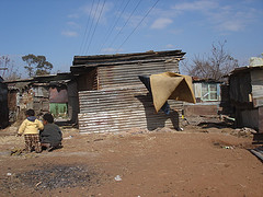
Mshenguville
Figure: Mshenguville Informal Settlement

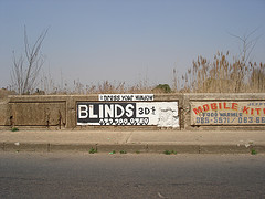
We returned to Mputhi Street and drove past Mshenguville Squatter camp, a former golf course. Further north on Mputhi Street, beyond the Roodeport intersection, the street name changes to Machaba Street. We turned right into Zulu Street and 200m ahead came to the site where Tsietsie Mashinini addressed crowds of students on the landmark bridge. The bridge is relatively unchanged since the 70s. Here Mashinini exhorted the students to remain calm and protest peacefully.

tsietsie landmark bridge
Figure: The Bridge where Tsietsie addressed students.

We continued towards Orlando West past the point where Machaba Street becomes Mahalafele Street, turned right into Phiri Street and left into Vilikazi Street. Our journey ended on Vilikazi Street at the intersection with Moema Street outside Phefeni Junior Secondary School. This is where students congregated on the morning of June 16 1976. Today this intersection has been memorialised by a monument marking the shooting site of Hector Pierterson. For many this is where the march ended as waiting police opened fire on protesting students.

Sources:

1. Moss, G. (1982): 'Crisis and Conflict: Soweto 1976-7', MA dissertation, University of the Witwatersrand.

Labels: , ,

Sunday, August 19, 2007

Process: Madibane High School

Date: 08 August 2006
Route Guide: Ali Hlongwane (Curator HPMM)
Documenter: Ismail Farouk

On the 8th of August 2006, Ali Hlongwane and I set off to retrace the route taken by students from Madibane High School in Diepkloof. The street layout of Diepkloof differs from the rest of Soweto. Most roads form crescents and there is an absence of street name signage. As mentioned before most major roads are named ‘Immink’, which adds to the confusion when trying to navigate the suburb.

Madibane High School Start

Figure: Madibane High School Route Starting Point

After much difficulty, Ali and I located the spot on the eastern boundary of the school on Ramosi Street, where the small gate exit was located in 1976. Today the small gate is no longer in use and the school has been fenced off. This is where students began their march on June 16 1976 from Madibane high School. Ramosi Street forms a crescent and we followed the road in a northerly direction and then in an easterly direction before coming to a T-junction.

We turned left into Patrick Street and right into the major Immink Road and proceeded south towards the intersection of Immink Road and Eben Cuyler Street. We crossed the intersection and stopped outside the sports grounds to our left. This is where students from Madibane High School joined the group from Junior Secondary School. Their intention was to march to Orlando stadium but news of the killing of Hector Pieterson filtered through and the intended march did not take place. Instead students became angry and set off on a rampage destroying all government administration buildings.

Diepkloof Sports Grounds

Figure: The meeting spot - Diepkloof Sports Grounds

One of the buildings which was targeted was a WRAB beer hall which was located on the intersection of Eben Cuyler Street and Immink Road. The beer hall was looted and gutted by students on June 16. The looting was followed by drinking and partying, signaling that the next few days were destined to be spent at home.


WRAB Beer Hall Diepkloof

Figure: The WRAB Beer Hall Site - Diepkloof

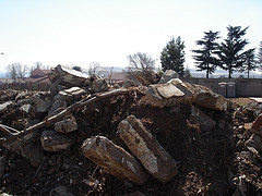
A bit further down Eben Cuyler Street, Ali pointed out the “Blackjacks” offices. “Blackjacks” were police who enforced influx control. Today, the offices have been reduced to rubble. New social facilities are being developed on the site.

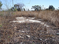
Blackjacks Influx Control - Remainig Rubble

Figure: Rubble from the original Blackjacks offices

Diepkloof remained as one of most active townships in 1976 where running battles between police and students continued for some time later. For the rest of the year, all schools were closed, with no further learning taking place.


Labels: , , ,

Process: Junior Secondary School Route

Date: 10 August 2006
Route Guide: Ali Hlongwane (Curator HPMM)
Documenter: Ismail Farouk

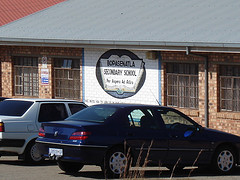
On the 10th of August 2006, Ali Hlongwane and I set off to retrace the Junior Secondary School route in Diepkloof. Junior Secondary School has been renamed to Bopasenatla High School and is located on Sono Street in Diepkloof. Sono Street exists on an east-west axis and was difficult to identify, mainly because of the absence street signs. Ali spent his childhood years in Diepkloof and has an intimate knowledge of the many passageways and unnamed roads which characterise the area. His knowledge and memory of the area was invaluable as we struggled to find appropriate street names. Our map of the Diepkloof area was highly inaccurate and still bears coded reference numbers as street names. To add to our confusion, Diepkloof has many streets and roads with the same name. Most roads are called ‘Immink’.

Junior Secondary School
Figure: Junior Secondary School

After documenting the current schoolyard, Ali pointed out an adjacent vacant lot which was the site of WRAB offices in 1976. The WRAB offices were destroyed in the aftermath of Hector Pieterson’s killing. The land has remained undeveloped ever since.

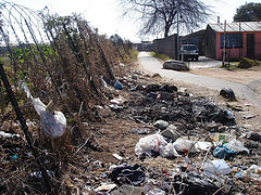
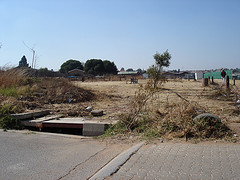
We began by crossing Sono Street and walked in a northerly direction towards Mbila Street which forms a crescent. At the northern end of Mbila Street we proceeded through a pedestrian passageway which connects with Dlanga Street which also happens to form a crescent. We continued on our northerly trajectory through a second pedestrian passageway. The environmental conditions through both the passageways were very poor. The area was characterised by illegal dumping along the edges.

Diepkloof Passageway
Figure: The first passageway

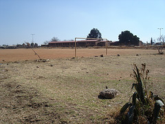
At the northern end of the second passageway, we stopped near a dusty soccer field. From here we could clearly see Vulazamazibuko Higher Primary School just ahead. This is where Ali went to School in 1976. He commented on how he still remembers seeing large crowds of students emerging from the passageway which we had just walked through on their way to meet students from Madibane High School. This is where Ali joined the march.

Dusty Football
Figure: Dusty Football Field

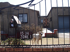
On the northern boundary of Vulamazibuko Higher Primary School, on Tsekuhle Street, Ali pointed out the house of the Zulu shaman, Credo Mutwa. Credo Mutwa’s house was destroyed during the uprisings for comments he made regarding the negative nature of the uprisings. After a brief pause, we continued north on Immink Street. We stopped at the intersection of Immink and Eteza Streets, where Ali pointed out his childhood home to me.

Ali Childhood Home
Figure: Ali Hlongwane's Childhood Home

Ali commented on how drastically the environment has changed over thirty years. Further down Eteza Street, new larger residences have been built. One such residence, on the corner of Eteza and Umhanga Streets was a former WRAB office which was also attacked and destroyed during the uprisings. At the end of Eteza Street we paused and looked at the park and offices ahead. The offices ahead were WRAB administration buildings which were burnt and destroyed. Today, the former WRAB site is home to municipal rental offices. The park which surrounds the municipal offices exists in a poor, overgrown state. Ali commented that the park has been recently upgraded but a lack of management has led to its current poor condition.

Overgrown Park Diepkloof
Figure: Overgrown Park Diepkloof

We turned right up Immink Road and continued in a Northerly direction on our final part of our journey towards the sports grounds near Eben Cuyler Street. Here students joined the group from Madibane High School but instead of marching to Orlando Stadium as intended, news of Hector Pieterson’s death filtered through the ranks and the intended peaceful march turned to anger as students attacked buildings associated with the apartheid regime.

Labels: , , , ,

Thursday, August 16, 2007

Process: Tshesele High School Route

Date: 03 August 2006
Route Guide: Antonette Sithole (June 16 Foundation)
Documenter: Ismail Farouk and S'phelele Nxumalo (ASM)
Observer: Oupa Moloto (June 16 Foundation)

On Thursday 3rd August 2006, Our research group began to map the route taken by Antonette Sithole on June 16 1976 from Tshesele High School in Central Western Jabavu to Phefeni Junior Secondary in Orlando West. Sithole is Hector Pieterson's older sister. Today she works for the June 16 Foundation which is located within the Hector Pieterson Museum.

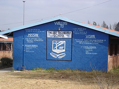
Thesele High School
Figure: Tshesele High School

At the beginning point, within the Tshesele school grounds, Sithole described how students from the nearby Morris Isaacson High School came to her school to collect students in their united march against the oppressive system. Sithole said, “We were very happy with pride, we were looking forward to uniting with other schools. It was the first time that students were without parents and so very happy. No one told us what to do and we were happy to miss school. Singing and chanting…we were told to be calm and not to provoke the police…We planned to walk on the main street but took short cuts to avoid police”.

We left the school grounds and walked in a northerly direction on Diokane Street. I asked Sithole how her brother Hector got involved in the march, to which she replied, “The younger one's saw us leaving in our uniforms and wanted to join the excitement".

We turned right off Diokane Street, into Mavi Street and left into Mlangeni Street and proceeded west towards Mputhi Street. At this point, Tshesele High students joined the main group from Morris Isaacson High School. Today a general dealer called Sizwe Stores is located at this meeting point. In 1976, there was a coal yard on the site. Oupa Moloto commented that there were about 2000 students in the group outside the coal yard.

From this point, Sithole directed us north on Mputhi Street past the Mshenguville Squatter camp. We soon turned right onto Mwasi Street and proceeded through Mofolo Park on Mzilkatzi Street.

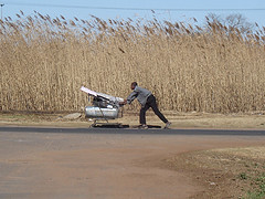
Trolley Pusher Mofolo


Figure: Trolley Pusher on Mzilkatzi Street.

We turned right into Mptipa Street and stopped outside the home of Dr. Nthato Motlana. Dr. Motlana devoted his live to serving the community of Soweto. He was the founder of the Black Medical Discussion Group in the late sixties to raise funds for struggling medical students and was involved in many other community organisations (Mashabela 1987). It was here outside the home of Dr. Motlana where Tsietsie Mashinini addressed students warning them about a police presence and calling for calm.

I asked Moloto how Tsietsie got to this point as he had just addressed another group of students at the landmark bridge on Machaba Street. Moloto explained that unmarked vehicles were used by the coordinators of the march on the day. He suggested that the vehicles were hired by members of the ANC. Tsietsie was driven around and was therefore able to address various groupings of students at various stages of the march.

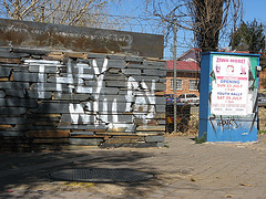
The route meandered along Mtipa Street and we soon turned uphill on Butshingi Street. At the top of Butshingi we turned right into Vilikazi Street. Further on Vilikazi Street we stopped at the official shooting site of Hector Pieterson on the corner of Vilikazi and Moema Streets. The memorial is often vandalised by youth who express themselves through graffiti.

They Will Pay
Figure: The Memorialised Shooting Site

According to Sithole, the location of the official shooting site differs from the actual spot where her brother was shot. She remembers the shooting site being closer to the corner of Moema and Phiri Streets where she was hiding in the yard of the corner house.

Antonette Sithole
Figure: Antonette Sithole relives the events of June 16 1976.

I asked Sithole what happened here once she got here? Sithole relates: "When the shooting began, I went into hiding. When the shooting stopped, I came out of hiding when others came out. I saw Hector across the street, and I called him and waved at him, he came over and I spoke to him but more shots rang out and I went into hiding again. I thought he followed me but he did not come. I came out of hiding and waited at the spot where I just saw him but he did not come. When Mbuyiso came passed me a group of children were gathering nearby. He walked towards the group and picked up a body...And then I saw Hector's shoes".

Famous Photo Site
Figure: The Famous Photo Site

A short time later Sithole was running beside Mbuyiso who was carrying Hector Pieterson. They headed towards Phomolong Clinic along Sisulu Street. Along the way, a photographer called Sam Nzima took the famous picture of the distressed children.

Whilst at the clinic Sithole watched a frenzied mob kill a white municipal worker who was later identified as J.N.B. Estherhuizen. He was dragged from his car and brutally killed. Estherhuizen was one of two white officials killed on the day.

phomolong cliinic
Figure: Phomolong Clinic

Hector Pieterson was pronounced dead here at Phomolong Clinic. Today, Sithole continues to keep her brother's memory alive with her work at the museum and as a public speaker. When not in the museum, she can be found on the streets of Soweto, physically laying the bricks on the the route taken by students on June 16 1976.


Labels: , , ,

Process: Mapping The Naledi High School Route

Date: 22 August 2006
Route Guide: Patrick Lephunya, Regional Director of Soweto
Facilitator: Ali Hlongwane (Curator HPMM)
Documenter: Ismail Farouk
Observers: Oupa Molota (June 16 Foundation),
Angel David Nieves, PHD. (Director Graduate Research & Training, Consortium on Race, Gender, and Ethnicity at Maryland University)

On the 22nd of August 2006, our research team retraced the Naledi High School Route under the direction of Patrick Lephunya, the regional director of Soweto.We began our journey at the school where Lephunya described the events of the morning of June 16, “At assembly the principal NJK Molope came in and wanted to sing a hymn but students stood up and shouted out, ‘Amandla!’ and sang ‘Nkosi Sikelele Afrika’ instead. The students unfurled banners and plackards before heading off into the streets”.

Naledi High School
Figure: Patrick Lephunya (left) describes the morning's events at Naledi High School

Lephunya showed us the telephone lines outside the principal’s office which were cut in order to prohibit any calls to the police. Earlier, on the 9th June, two policeman came onto the school grounds to arrest a student. The student in question, Enos Ngutshane was wanted for questioning.
The principal came into our classroom and said, ‘hey, mmona (man) it looks like you are in trouble the police are here and they would like to go with you’. Then he went back to his office and continued the discussion with the police just to find out what is happening, “I took my bag instead of going to the principal’s office I went to the classrooms where the members of the South African Student Movement (SASM) were and said, ‘guys I’m in trouble the police are here to arrest me’. So there was a quick discussion and the guys said, ‘you know what don’t go to the office, you go back to your classroom and give us 10 minutes [Laughs]’. So I was looking at my watch exactly 10 minutes the bell went. But it was not natural; it wasn’t supposed to be ringing at that time. But they had done their work. They had already moved into all the classrooms to say the bell is going to ring and all of us must be at the assembly. So we went to the assembly and students were in one voice ‘you are not going anywhere’.
Later, Ngutshane walked in the principal’s office and said ‘this is the situation it looks like nobody is going to leave the school, including myself [Laughs]’. So there was pandemonium in the principal’s office. As the three of us were still talking, the white policeman, the principal and myself, the other police guy came in and said, ‘hey, the car is now on fire outside [Laughs].
The police car was destroyed, burnt and overturned. Unfortunately the students did not cut the telephone line on time and police reinforcements soon arrived.

(Extract from an interview with Enos Ngutshane)


After, a brief inspection of the school grounds, and the memorial to those who lost their lives in a bus tragedy in Mozambique in 1974, our group set off in a hired mini bus.

Contrary to popular belief, the Naledi High School Route does not make a beeline to Morris Isaacson School as illustrated by the proposed paving route on the Johannesburg Roads Agency map., The Naledi route remains highly contested. However, the initial stages of the route shown to us by Lephunya, is corroborated by Harry Mashabela in his book, “A People on the Boil”. The book contains a very detailed description of the initial stages of the Naledi High School Route.

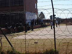
Batswana High School
Figure: Batswana High School

Our first destination was Batswana Junior Secondary School, which is located close to Naledi High School in a South Eastern direction. Today, Batswana Junior Secondary School is known as Thabo Secondary School. Lephunya described how students from the school gathered at the small gate as they waited for the Naledi group to arrive before heading off to Thomas Mofolo High School.

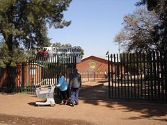
Thomas Mofolo High School
Figure: Thomas Mofolo High School

At Thomas Mofolo Senior Secondary School, a further 500 students waited to merge with the Naledi group. Our journey continued down Mpetslane Street where Lephunya pointed his mother’s house out. On the morning of the march Lephunya stopped here to drop his school books off before continuing with the march. He also added that there were no incidents at this point of the march.

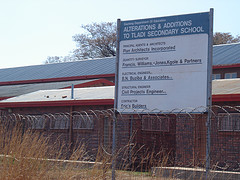
Tdladi Secondary School
Figure: Tladi Secondary School

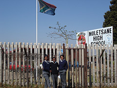
Lephunya directed the minibus right and then left onto Legwale Street before turning left onto Thamagane Street where more students from Tladi Secondary School joined the march. We meandered through tiny unnamed residential streets, and a few sharp turns later we found ourselves back on the main road, Masiane Street. Our next stop was Moletsane High School where students asked us to photograph them in front of the school. We continued on Masiane Street and turned right into Mphahlele Street where we stopped outside Mphahlele High School.

Moletsane High School
Figure: Moletsane High School

The next part of the route is where the greatest contestation lies. The plan on the day was to merge with students from Morris Isaacson High School and this is supported by Harry Mashabela’s book, which describes the scene when the Naledi group arrived at Morris Isaacson High School to find the school deserted with a sign at the gate which read, “No SB’s – Trespassers Beware!”. Lephunya’s route, however, does not include Morris Isaacson High School, rather it meanders through the ‘big circle’, at Letabe Street in Central Western Jabavu, east of Morris Isaacson High.

An explanation for the contestation can be found in the fact that not all students followed the same path. While the majority of students may have taken the path described by Lephunya, it is possible that some students from Naledi walked along Makapan Street before turning right into Mputhi Street towards Morris Isaacson High School. This possibility can be explained by the testimony of Solly Mpshe in the book “June 16 1976” by Brink and Malungane (2001). Mpshe was a student at Morris Isaacson High School. He relates being forced out of his class and being forced to march despite not knowing what was going on. He says that this occurred during the second period around 09.30am and places responsibility for being forced into marching on students from Naledi High School (Brink and Malungane 2001:39).

Lephunya’s route continued on Letabe Street in a northerly direction until the street changes name to the Moroko Nancefield Road. We turned left into Mncube Street and continued westwards towards Mahalefele Street. We turned right on Mahalefele Street but instead of turning towards Vilikazi Street, the end point for many other school routes, we continued down towards the Klipspruit River close to the point where Hastings Ndlovu was killed.

Hastings Ndlovu Shooting Site
Figure: Hastings Ndlovu Shooting Site

We stopped just before the bridge on Kumalo Street. On the other side of the bridge is where police were reported to have congregated. Lephunya’s version of the Naledi High School route ends here.

Sources:

1. Brink, E. and Malungane, G. (2001): Soweto 16 June 1976, Personal accounts of the Uprisings, Kwela Books, Cape Town.
2. Mashabela, H. (1987): A People on the Boil, Reflections on Soweto, Skotaville, Publishers, Johannesburg and Cape Town.


Labels: , ,